New Comprehensive Plan of the Territory of the Republic of Lithuania
New Comprehensive Plan of the Territory of the Republic of Lithuania (CPTRL) is a spatial territorial planning document that defines spatial development aims and functional priorities for the use of territories, ensuring compatibility of strategic planning with spatial (territorial) documents valid in Lithuania.
The new CPTRL is a system that ensures the spatial integrity of all country strategies. It will enable the reconciliation of the various activities e.g. business, agriculture, tourism, recreation, protection of the environment and cultural heritage, creation of infrastructure and more.
The current Comprehensive Plan of the Territory of the Republic of Lithuania will expire in 2020, so a new strategic document should be prepared by then which will be used by specialists of various fields.
The purpose of the CPTRL is to establish spatial integration policy, use and protection priorities for the country in accordance with Article 3 (1) of the Law on Territorial Planning of the Republic of Lithuania.
The importance of this project is illustrated by the fact that the Government of the Republic of Lithuania has included it in the Strategic Project Portfolio which contains priority work of all ministries.
The CPTRL is expected to become the main development document of the country, the decisions made in this document will be valid until 2030, and the proposed vision will be valid up until 2050. Decisions are also crucial to achieving the UN Sustainable Development Goals, for which each country has to devise specific measures.
The objective of the CPTRL preparation process is to analyse, evaluate, discuss with stakeholders and propose a common and integrated vision of spatial, environmental, social and economic development of the territory of the country, to formulate priorities and directions of use and protection in accordance with the provisions of the Law on Territorial Planning of the Republic of Lithuania, based on international recommendations and good practices of the integrated planning of the EU countries.
The next generation of CPTRL must be prepared and approved within three years. The first stage, i.e. the analysis of the current state, was completed in May 2019. In the later stages, the concept of the CPTRL will be formed, which will have to be approved by Lithuanian parliament – Seimas while design decisions will have to be approved by the Government of the Republic of Lithuania.
European Context
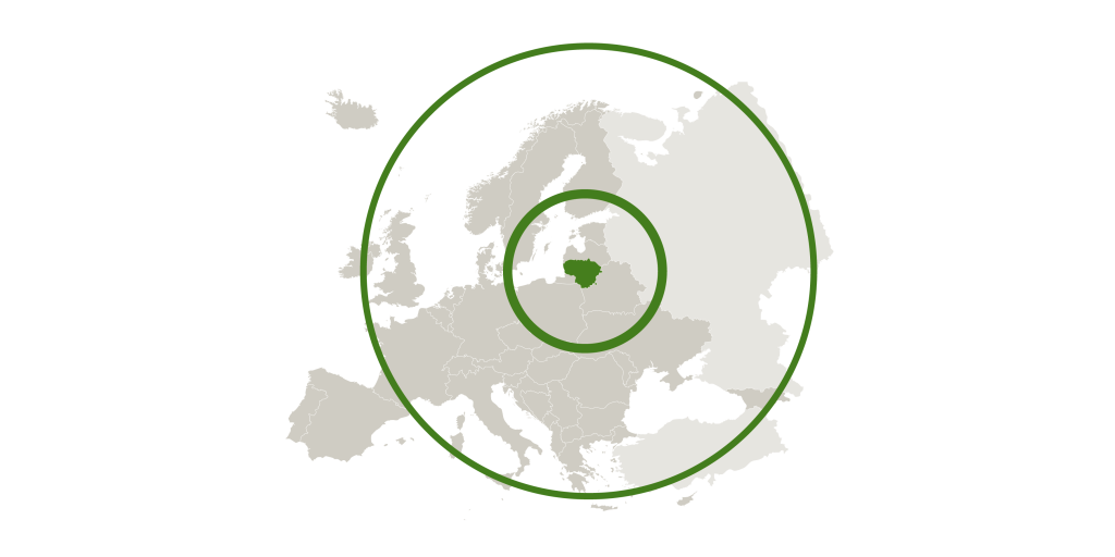
In Europe, density indicators of the territory of Lithuania are one of the lowest, and there are no visible large-scale development processes. Lithuania seems to be relatively safe. The number of economically active people clearly reflects the economic cycle and EU trends, and the unemployment rate is basically the same as the EU average. Economic productivity in Lithuania is still lagging behind the EU average but the economy has grown two to three times faster than in the old EU countries since 1996. Income is still falling behind, however, it counterbalances the price level which is about 25% lower in our country than in the EU. Compared to the EU, more people receive relatively low income in Lithuania and much more people would not be able to cover their unexpected expenses. Although indicators are improving, people who think that life is getting worse have increased significantly over the decade, however, other EU countries have experienced similar changes. Relatively many people work in poorly paid jobs, but in contrast to the EU, young people are better of and occupy 30 lees positions in such jobs than EU average. According to life expectancy, Lithuania is lagging behind EU countries and it lags far behind the EU average.
Lithuanian Context
Migration trends in Lithuania are disturbing – the population is decreasing. Municipalities who lost the most people since 1996, are the ones still in decline in 2016. It mostly concerns regions where unemployment is high. According to the unemployment rate and the share of the long-term unemployed persons, Utena region stands out. The smallest number of people earning more than the minimum monthly wage is relevant to several counties in Western Lithuania, which is regarded as a problematic region. The best situation is in the Vilnius region.
Most people work in industry and trade areas in all municipalities. Investment per capita grew in 2004-2016 throughout Lithuania but pre-crisis levels of 2007 has not been reached.
The biggest GHG emissions come from the energy sector in Lithuania. Although our country is one of the cleanest in Europe in terms of air quality, changes indicate that there are variuos issues at national, municipal and local level.
System of Strategic Planning Documents
Currently, in Lithuania, there are over 200 strategic planning documents with various time spans. 98 of them are regarded as the most important, 28 long-term, 51 medium-term and 19 short-term planning documents. The most important documents are the following:
“Lithuanian Progress Strategy 2030” (Long-Term Planning Document) and “Lithuania’s Progress Strategy 2030” (Medium-Term Planning Document): to develop the concept of an integrated sustainable development in order to implement the provisions of the UN Agenda 2030.
The National Landscape Management Plan was prepared and approved in 2015 and it establishes a long-term landscape protection strategy. Two more strategic planning documents are important for CPTRL are the following: the National Environmental Protection Strategy and the White Paper on Lithuanian Regional Policy which forms the guidelines for regional policy. In order to reduce the number of strategic planning documents and increase the relevance of their provisions, it is appropriate to integrate the relevant provisions of the Sustainable Development Strategy and the Long-Term Development Strategy into the concept of the CPTRL under preparation.
Concept of MPTRL
MPTRL is the main spatial territorial planning document which provides a long-term perspective for the development of the territory of the country, and it will become one of the main development documents of the Lithuanian country. Its will formulate solutions that will last until 2030, and the proposed vision will be valid up until 2050. The state-level comprehensive territorial planning documents are public.
The concept of CPTRL is developed primarily on the basis of a broad and comprehensive sectoral and cross-sectoral analysis and conclusions of the current situation. This analysis, system of indicators and their correlation methodology, enables us to see the overall picture of the spatial structure of Lithuanian territory, and forecast development tendencies. Conclusions about the current state indicate trends, tendencies and problems of the state territory spatial development. Problematic themes and problematic habitats are distinguished.
The planned territory is the land and sea areas of the country, including the territorial sea and territories where Lithuania exercises sovereign exclusive rights – the adjacent zone and the exclusive economic zone (EEZ) with the continental shelf.
In implementing the principles of sustainable development, the main task of the MPTRL is to preserve and highlight the territorial identity of the country in the European context and to create the foundations of a competitive state. Once the concepts and functional priorities of spatial development are identified in the concept of MPTRL, solutions that are crucial to achieving the UN Sustainable Development Goals will be specified.
Methodology for the Development of the MPTRL Concept
Based on the analysis and assessment of the actual condition, development tendencies and forecasts, the general objectives of development are determined and solutions are developed that determine the main directions of development: the spatial development trends of the state territory are presented and functional priorities of the use of the isolated habitat territories are determined.
Developing the Concept, a document defining the scope of strategic environmental impact assessment is prepared and discussed with responsible institutions, strategic environmental impact assessment of solutions (hereinafter referred to as SIEA) is carried out and presented for public discussion and taking consultations regarding the prepared solutions.
General Aims of Concept Development
Conceptual solutions must reflect the priorities of the country, and the conceptual process must be inclusive and open to proposals and dialogue between institutions, society, various professional groups.
The concept needs to be presented in an understandable, clear, structured way. There must be integrated state-level conceptual solutions with strategic documents. This is the basis for concrete solutions.
Download the Methodology for the Development of the MPTRL concept
Strategic Topics of the MPTRL Concept
System development is differentiated according to the territorial elements of the country

Strategic topics
- Successful, social and sustainable cities
Optimization of urban framework centre system, compact urban formation, high urban planning culture, preservation and overcoming of urban cultural heritage, full living conditions, sustainable urban economy, mobility, sustainable use of resources, vibrant natural environment, optimal landscape structure, climate change mitigation. - Organic, economical (sustainable) agriculture and vibrant rural areas
A lively natural environment, an optimal landscape structure, lively rural areas, full living conditions, sustainable economy, mobility, resource efficiency, and territorial differentiation of agricultural activities. - Responsible use of the sea and coast.
Non-invasive urbanization, state of marine ecosystems, recreational exploitation of potential, sustainable blue economy, measured port development and multimodality, sustainable use of resources, renewable energy sources, and climate change mitigation. - Natural areas are the foundation of ecological stability
A lively natural environment, optimal landscape structure, managed urbanization, efficient use of the recreational potential of natural areas, sustainable economy, mobility, sustainable use of resources. - Interactions and interfaces that create synergies
Partnerships: a city – a city, a city – a village, transport links, territorial aspects of economic movement (FEZ), a functional natural framework, and engineering links of regional importance. - Strong territorial identity
Conservation and sustainable use of existing values (protected areas, cultural heritage, and ethnographic regions). Landscape and regional self-awareness, i.e. specialization, ensuring recreation and tourism, involving communities that shape local identity. - Strategic Objects
Lithuanian strategic object system, List pf Objects. - Competitive State
Strengthening of national metropolitan structures visible in the European context (Vilnius, Kaunas, Klaipeda), development of communication links with foreign countries: attractive country of logistics, flexible, quickly adaptable to the needs of economic entities, planning documents, system of procedures, disclosure of identity, existing cultural and natural resources values, potential.
Polycentric structure of urban centres
Polycentrism is a concept that encourages regions and cities to work with adjacent territories, exploit common strengths and unlock potential additional benefits that can deliver added value and cannot be achieved by acting alone.
Continuity of the valid MPTRL: “To form and consolidate a hierarchical polycentric network of residential areas in Lithuania, ensuring the most favourable conditions for social, economic and ecological development of the country and preconditions for high quality of life of people.”
The polycentric system is promoted by documents forming the Lithuanian development strategy (for example, the White Paper on Lithuanian Regional Policy).
2 Alternatives to Spatial Development of Lithuanian Territory
Alternative I
The strongest centres operate independently in their individual regions

Alternative II
Partnerships between the centres are being developed and individual territorial competitiveness is promoted

The concept is developed in accordance with the Integrated Territorial Planning Document Preparation Rules.
Contacts